
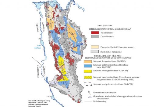
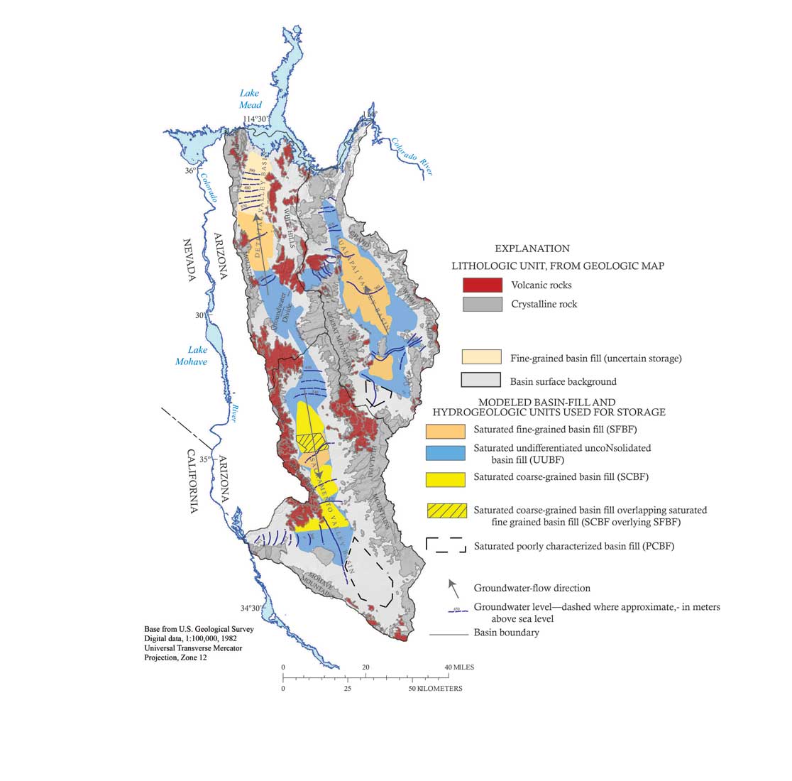
Title of graphic: Simplified Geologic map and Hydrogeologic Units used for Groundwater Storage in NW Arizona Basin.
Type of graphic: Illustration for a published scientific report
Client: Arizona Department of Water Resources, Mohave County Water Commissioners, City of Kingman, General Public
Communication objective: To Illustrate movement of groundwater, basin lithology, and sediment classification, relative to estimates for groundwater storage.
Type of content provided: Geologic maps, groundwater potentiometric surface and water table; sub-surface sediment or rock characteristics.
Software used: ArcGIS (Arc Map), Surfer graphing program, Microsoft Excel, Adobe Illustrator, Adobe Acrobat
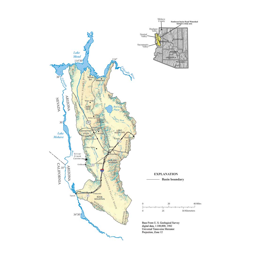
Title of graphic: Study area Location map in NW Arizona
Type of graphic: Illustration for a Published Scientific Report
Client: Arizona Department of Water Resources, Mohave County Water Commissioners, City of Kingman, General Public
Communication objective: To illustrate the physiography and location of the study area relative to the State of Arizona.
Type of content provided: ArcGIS shape files
Software used: ArcGIS (Arc Map), Adobe Illustrator, Adobe Acrobat